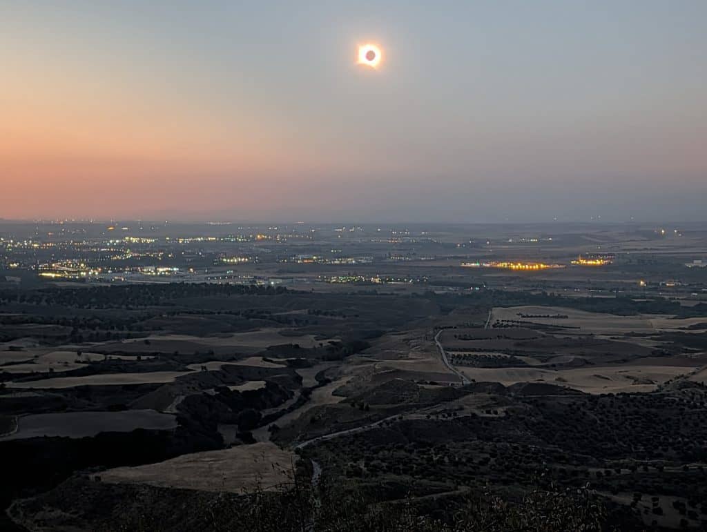
My family and I went to Los Santos de la Humosa on August 12, 2026, for the total solar eclipse that swept across northern Spain that day, the first to touch the Iberian Peninsula in over a century. That day became the subject of a separate post, “A Total Eclipse Came to Los Santos de la Humosa. The Town Kept Its Own Time.”
But the research behind that piece turned up far more than a single day trip could hold, centuries of layered history the eclipse account never had room for. I tried, at first, to fit all of it into that same post. It took a conversation with my wife, and her patient insistence that the piece was trying to do two different jobs at once, to see it clearly. The history deserved its own room, not a few compressed paragraphs competing for space with the story of the day itself.
This is the other half of that story: not the eclipse, but the village itself, a small place in the Corredor del Henares that turned out to have a great deal more going on than a single afternoon could show.
Los Santos de la Humosa carries two names stitched into one, and neither half of it has ever been fully settled. Most people driving past it on the road to Guadalajara probably never stop to ask why. Underneath the village sits unexpected depth: prehistoric fossils, a Roman milestone, a resettlement that may have had less to do with disease than with a frontier war whose stakes in a village this small have mostly been forgotten. A church and a hermitage still stand at the top of it all, having quietly outlasted a jurisdiction dispute that took two centuries to resolve and a civil war that killed the village’s own priest.
Fossils and Stone Tools, Long Before Anyone Named This Place
Long before anyone gave this place a name, the land itself was already a dynamic center of life, host to creatures large and small millions of years before any human ever set foot here. Two paleontological sites, formally designated Henares-1 and Henares-2, sit west of the municipality, right at the boundary with Alcalá de Henares. They preserve fossils from the Middle and Upper Miocene, roughly sixteen to five million years old. Reptiles turn up here, including a giant terrestrial tortoise a full meter long, alongside mammals like bears, hedgehogs, and hares. A younger layer holds plant and freshwater fossils, tied to the same limestone páramo, the high, flat tableland characteristic of this stretch of Castile, that surrounds the village today. Los Santos de la Humosa is one of the few municipalities in the entire Comunidad de Madrid with a fully completed paleontological survey. It’s part of the same broader Miocene story that produced Cerro de los Batallones, one of Spain’s most celebrated fossil sites, elsewhere in the Madrid Basin.
People arrived much later, but still thousands, not millions, of years ago. The oldest archaeological material found here belongs to the Lower Paleolithic, conventionally dated from roughly 2.5 million years ago down to about 100,000 years before the present. It’s the same tradition responsible for well-documented river-terrace sites elsewhere in the Madrid region, like Aridos in the nearby Jarama valley. What survives specifically at Los Santos de la Humosa hasn’t been catalogued in that same detail, only broadly identified as belonging to this era, but early humans across this stretch of river country were consistently drawn to ground like this, close to water.
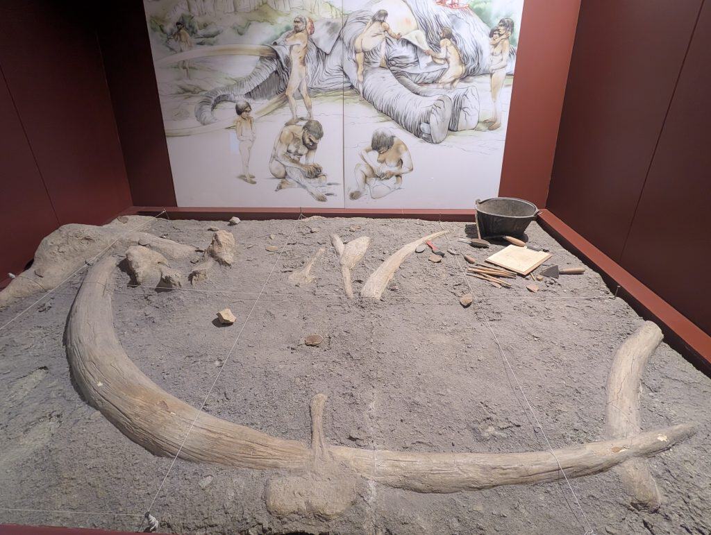
Neolithic finds, roughly eight to three thousand years BCE, mark a real technological and cultural shift from what came before. The word Neolithic itself means “new stone,” referring to a specific new technique: grinding and polishing stone tools smooth rather than chipping and flaking them. That shift went hand in hand with a bigger one, from nomadic hunting and gathering to a settled life built around farming, herding, and, for the first time, pottery. Los Santos de la Humosa’s own evidence, polished stone axes and early ceramics recovered along the banks of the Henares, matches material already well documented at Soto del Henares, further along the same river.
Later still came the Copper Age, beginning around 3,500 BCE on the Iberian Peninsula, when metal first entered the human toolkit. It was prized at first for its shine and, being more durable than worked flint, soon put to practical use as well. The Bronze Age followed from around 2,500 BCE, once smiths learned to alloy copper with tin, a metal scarce enough to pull the whole peninsula into new trade networks reaching across the Mediterranean. Los Santos de la Humosa has its own material from both periods, worked flint tools and hand-shaped ceramics, documented in academic proceedings on the history of the Henares valley. Further down the same river, at La Serna in nearby Arganda del Rey, an actual Bronze Age metalworking site has been excavated: kilns, a stone mold for casting axes, and a crucible still carrying traces of slag, physical evidence of bronze being made here, not just used.
Then Rome Arrived
The Bronze Age gave way to Rome. Complutum, the city that would one day become Alcalá de Henares, rose a few kilometers from here, first as a hilltop settlement. It moved down into the Henares floodplain in the middle of the first century for better access to water, growing from there into a regional hub in its own right. It sat at the crossroads of the roads linking Emerita Augusta and Caesaraugusta, modern Mérida and Zaragoza, prosperous enough that the emperor Vespasian granted it privileged city status in 74 CE. Complutum’s own fuller story is a subject for another post entirely; what matters here is what its rise meant for the smaller village a few kilometers upstream.
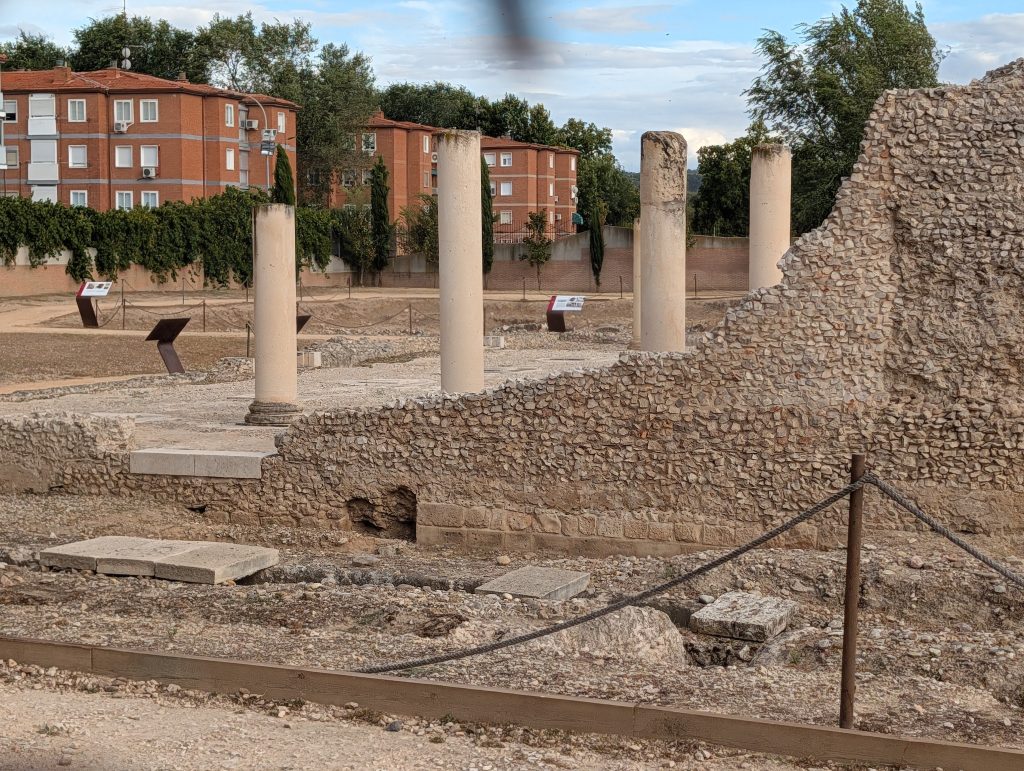
The countryside around a city like that filled in with agricultural estates rather than more cities. These holdings ranged from something the size of a small farm up to something closer to a village. Roman families settled wherever the land was fertile and the water close, which meant the Henares riverbank specifically. It was the same stretch of ground that had already been drawing people here for millions of years by then. Los Santos de la Humosa has its own Roman and late-Roman estates documented along that same riverbank. They’re part of the wave of settlement that filled the countryside around Complutum until the Roman presence in this region finally faded.
This stretch of river valley has been worth living on for an enormous span of time, long before Rome ever existed, longer still before anyone thought to write the place’s name down.
Smoke, Saints, and a Name Nobody Fully Agrees On
Nobody ever did write it down clearly enough to settle the question. There’s still no consensus on where the actual name, Los Santos de la Humosa, came from. It splits cleanly into two halves, and each one carries its own tradition, neither definitively proven.
Humosa, Spanish for “smoky” or “misty,” is the older half. One tradition is recorded in the Relaciones de Lorenzana, an eighteenth-century survey of local parishes across the Toledo archdiocese. It holds that a shepherd kept seeing smoke rise from a particular spot near the river, investigated, and found a buried image of the Virgin there, giving the place its name. Some writers push the story back further still, to a Roman-era settlement supposedly called Fumoso on the same stretch of riverbank, named for the mists the water threw off the land. It’s a good story, and it may well be true. But it isn’t a documented one. No source ties the Roman name to solid written evidence, only to tradition passed down across centuries, and it’s worth holding the claim loosely rather than repeating it as settled fact.
Los Santos, Spanish for “the saints,” is the other half, and its own tradition reaches directly into the founding story of Alcalá de Henares itself. Local belief holds that Justo and Pastor, the two child martyrs central to that city’s own religious identity, were natives of this village. This was back when it still sat in its original location, before the resettlement to higher ground. When the resettled town needed a new name, tradition holds it took theirs. A second, competing theory offers something plainer: the village may originally have been called Los Altos de la Humosa, Los Altos meaning “the heights” in Spanish, for its position up on the hills. Over the centuries, Los Altos gradually gave way to Los Santos, with the saints’ story attached only afterward. Both explanations remain in circulation. Neither has definitively prevailed, and the honest answer, at this distance, is that nobody alive can say for certain which came first, the saints or the corruption of a word for height.
What is documented, at least by an archaeological find rather than a legend, is a Roman milestone, pulled from the Henares near a rock formation locals call the Peña de Pedro Abad, recovered during work on a river dam. The account survives in the Relaciones Topográficas de Felipe II, the sixteenth-century royal survey of the kingdom, which describes the milestone as found roughly a dozen years before the survey itself was compiled. It was tall, thick, ancient, and carved with Latin letters, partially illegible by then. It’s generally thought to have marked a stretch of the Roman road linking Caesaraugusta and Emerita Augusta, modern Zaragoza and Mérida, passing through Complutum, Roman-era Alcalá, along the way.
Ambrosio de Morales, chronicler to the king, examined the milestone in the sixteenth century, and the book he put it in tells you exactly why he cared. It wasn’t a neutral catalog of local curiosities. It was a study written specifically to justify the costly, contested transfer of Justo and Pastor’s relics from Huesca to Alcalá. Morales wanted to root the whole region as far back into Roman and Christian antiquity as the evidence would support, precisely because doing so built his civic and religious argument for why Alcalá deserved to house the saints’ remains at all. The milestone found in this small village ended up serving as evidence in an argument that was really about a different town entirely: Alcalá, not Los Santos de la Humosa.
A fragment of it was documented in the cloister of Alcalá’s Colegio del Rey at least by the late eighteenth century, tradition crediting Morales with having it brought there. It’s the kind of small, easily overlooked artifact that can slip out of the historical record without anyone noticing, and whether it still survives in that same spot today is unknown. It’s a slender, physical thread tying this otherwise obscure village stone to the same saints the village still claims as its own.
A Village That Moved
The village didn’t stay by the river, a move already touched on in passing. Some time around the tenth or eleventh century, its people abandoned the original riverside site and resettled at the higher spot the village occupies today. Local histories attribute this to epidemics, unhealthy conditions on low, damp ground beside the Henares, and that explanation has circulated widely enough to be treated as settled.
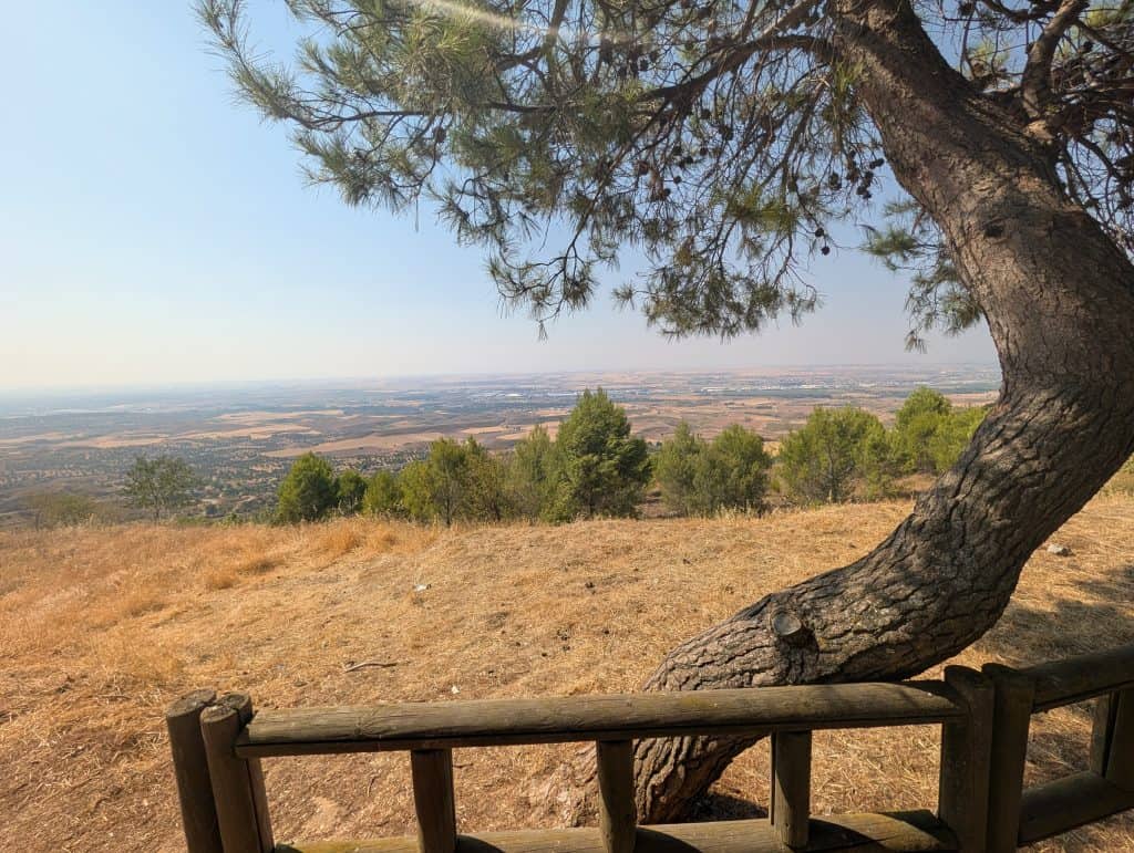
It probably shouldn’t be. Disease near a stretch of river like this one was a real risk historically. This exact region, the rolling tableland country of La Alcarria, later became the subject of its own academic study: a severe malaria epidemic that struck the area in the 1780s. But that documentation comes from roughly seven centuries after this village’s actual resettlement, and nothing survives from the medieval period itself tying epidemics to it specifically. Even so, the same low, damp ground that produced a documented epidemic seven centuries later would presumably have carried a similar risk in the tenth and eleventh centuries too, and that alone is reason enough to take the epidemic explanation seriously. Disease may well have been part of the real picture. It just shouldn’t be treated as the whole of it.
There’s a second explanation worth setting alongside it. This stretch of the Henares was also frontier country, and not the quiet kind. It sat inside the Marca Media, the Middle March, one of the frontier zones that Al-Andalus, the Muslim-ruled territories of medieval Iberia, formally maintained against the Christian kingdoms to the north. This whole centuries-long conflict is now generally known as the Reconquista.
A fortress a few kilometers away, at what’s now called Alcalá la Vieja, stood specifically to block Christian troops from descending the Henares and the neighboring Jarama valley. The Jarama is the larger river system the Henares itself flows into, before their combined waters continue on to the Tagus. Alcalá la Vieja has its own fuller story, and it will get its own future post.
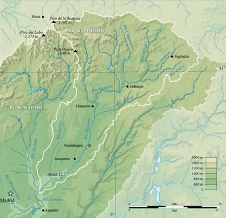
The danger was real enough that a young Castilian nobleman named Rodrigo Díaz de Vivar, better known by his legendary title El Cid, led a raiding campaign through this exact valley in 1081, four years before everything changed. Toledo, the old Visigothic capital and one of Muslim Iberia’s great cities, didn’t fall to Christian forces until 1085, a turning point that pushed the frontier decisively south.
The broader pattern across this exact stretch of the Henares and Jarama valleys is well established in the archaeological and historical literature on the region. Villages retreated to defensible high ground during periods of instability, then spread back down toward the river once the border settled and the immediate danger passed. Whether sickness or the frontier itself actually pushed this particular resettlement isn’t confirmed by any source specific to this village. But the timing, landing squarely in the middle of the most contested centuries of the whole frontier period, fits the second explanation at least as well as the first, and arguably better. The same pattern shows up consistently elsewhere along the same river system in the same era.
Counted and Contested
Once the frontier had moved south and the immediate danger passed, the village entered a different kind of history, one measured in land grants and jurisdiction rather than survival. In 1125, King Alfonso VII granted the whole Tierra de Alcalá, this village included, to the Archbishop of Toledo. It shows up in written records with the status of villa from the late fifteenth century. Villa status, a formal legal designation under Castilian law, meant more than a name. It gave the town its own local magistrates and its own governing council. The magistrates exercised civil and criminal jurisdiction over the town’s own territory, rather than depending on a neighboring town’s officials for justice. By the seventeenth century it was one of twenty-five such villas under Alcalá’s jurisdiction, part of a large, loosely federated territory answering to the same ecclesiastical authority.
King Felipe II later separated the village from Toledo’s authority entirely, securing a papal brief from Gregory XIII specifically for the purpose, and folded it directly into the Crown. It’s a change that sounds administrative, a matter of who technically held the deed, but that isn’t how it worked in practice. As long as the village and its neighbors all answered to the same archbishop, nobody needed to draw hard lines around shared pastures and water. The archbishop could always settle a dispute informally, without ever putting a fence where a fence had never been needed before.
Los Santos de la Humosa now answered only to the Crown, while its neighbors stayed under Toledo. Those same shared commons suddenly needed real, fixed boundaries, for the first time in their history. Lawsuits followed against neighboring Santorcaz and against Alcalá de Henares itself, over land and forest access. One specific dispute, over the passage and watering point at the Barranco del Lobo on the Henares, is described in local sources as having remained live into relatively recent times. Drawing fixed boundaries took decades. Some of the resulting disputes weren’t settled for nearly two centuries. This is a recognized pattern in the broader literature on villa segregation in Castile: separating a locality from a shared jurisdiction reliably produced exactly this kind of conflict, since communal land use that had never required formal boundaries suddenly did.
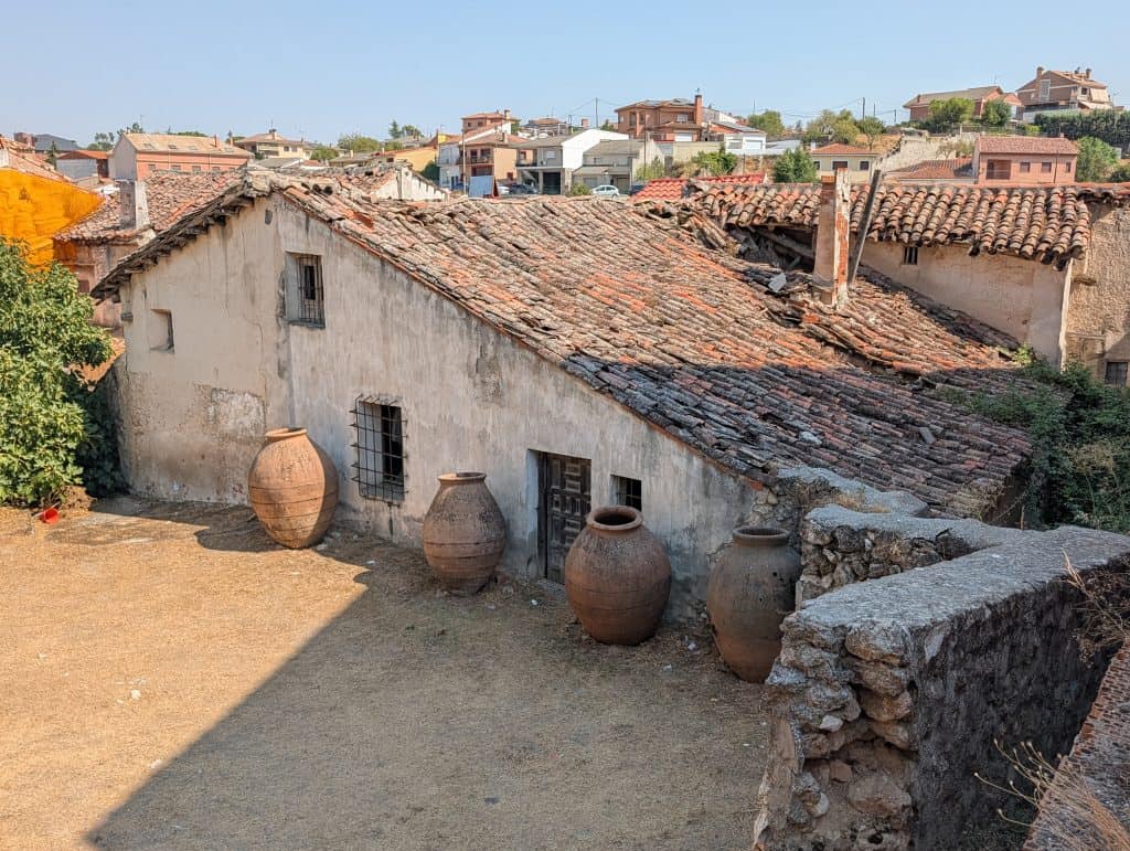
Amid all that legal wrangling, one detailed snapshot survives of what the village actually looked like, day to day, at a specific moment. By 1576, Ambrosio de Morales, the same chronicler who had puzzled over the Roman milestone decades earlier, described the place for Felipe II’s official survey of the kingdom. It counted 190 houses, two stories each, livestock kept on the ground floor, and roughly 900 people living off river fishing and farming. A flour mill from that same community later belonged for generations to the Jesuit college in Alcalá, until the Crown expelled the Jesuits from Spain in 1767. A resident of the village today is still called a santero or santera, the same word that, a world away in Cuba, names a priest of Santería. Here, it simply means you live in Los Santos.
The Church at the Top of the Hill
Some things outlasted all that paperwork. The Iglesia de San Pedro Apóstol is the oldest building standing in the village, sited at its highest point, a Bien de Interés Cultural, Spain’s highest legal category of heritage protection, since 1983.
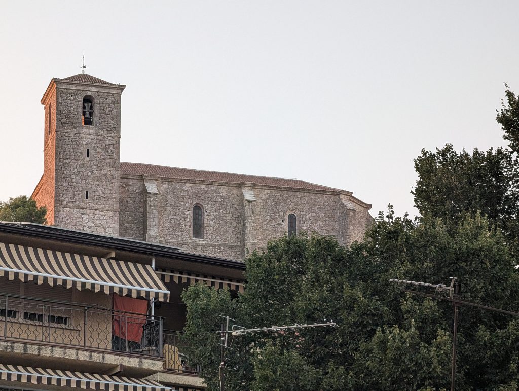
Construction began in 1562 under a master stonemason named Nicolás Ribero. He’d also worked on part of the façade of the University of Alcalá just over a decade earlier, in 1551, one small, unexpected link between this quiet village church and the far more famous Renaissance university a few kilometers away. That university was built under Cardinal Cisneros, the churchman who founded it in 1499 and, at the height of his power, governed Castile itself as regent. The university’s own fuller story will be a future post. Back in Los Santos de la Humosa, the church itself wasn’t finished until more than a century later, in 1677, by a different builder named Pedro Lamaza.
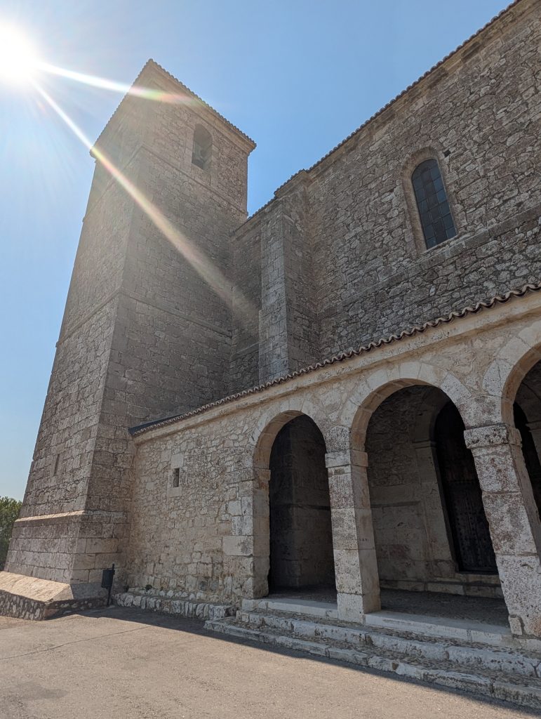
Plain and solid from the outside, the church is built as a single long hall in three sections, known as a nave. That hall ends in a rounded, many-sided chamber that holds the altar, what architects call the apse. A three-arched entrance porch, the portico, fronts the building on square pillars, topped off with a bell tower rising in three distinct levels, each marked off by bands of stonework.
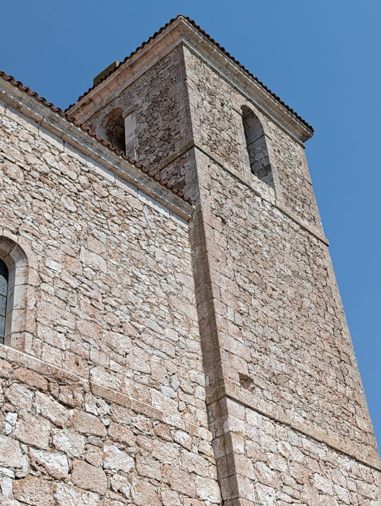
Some of the stonework was reused from an earlier church that once stood on the same site, according to the parish’s own historical marker. Nobody seems to know much else about that first building, not its name, not exactly when it was replaced, only that some of its stone went into the walls of the church that succeeded it. A sacristy, the room where vestments and vessels are kept, was added in 1596.
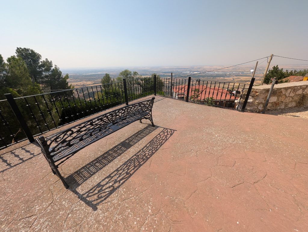
Inside, according to the village’s own informational signage, plain, smooth-sided columns with simple, unornamented tops, in a style architects call Tuscan, hold up the ceiling. That ceiling is a groin vault, formed where two stone arches cross each other, decorated here in an ornate Baroque style. A wooden choir sits at the entrance, and a small baptismal chapel under the tower holds an old stone font. Eighteenth-century paintings decorate the chancel, the area immediately around the altar. In spring, the same signage notes, swallows nest by the hundreds in the bell tower. The surrounding park also offers views the town itself is proud enough of to call one of the best sunset vantage points in the whole Comunidad de Madrid.
Not everything this building has survived is made of stone.
The Spanish Civil War, fought between 1936 and 1939, left its mark here in a way that goes well beyond a line on a plaque. Martín García García, the village’s own parish priest, was taken to the nearby town of Corpa and shot within days of the war breaking out, dying of his wounds on July 25, 1936. He was one of thousands of clergy killed in anti-clerical violence that swept Republican-controlled areas in the war’s opening weeks. That’s worth stating plainly rather than folding into a general gesture toward “wartime disruption.” General Francisco Franco, leading the opposing Nationalist side, cast his own uprising in explicitly opposite terms: a crusade to defend the Church from precisely this kind of violence. That framing helped him secure the Spanish bishops’ public backing, and it shaped a close alliance between his government and the Church that lasted for decades after the war ended.
The Hermitage on the Road to Pozo de Guadalajara
An eleven-minute walk downhill from the church, along Calle Mayor and out toward the edge of the village on the road to Pozo de Guadalajara, brings you to the Ermita de la Virgen de la Soledad, a small sixteenth-century hermitage. In Catholic tradition, a hermitage refers to a small, freestanding chapel, typically without a priest in permanent residence or regular daily services. Access was generally open to the surrounding lay community, who gathered there for specific feast days and processions rather than everyday worship, a pattern this hermitage still follows today. This particular hermitage was built in 1576 under the auspices of the Hermandad de Nuestra Señora del Rosario, the Brotherhood of Our Lady of the Rosary.
The hermitage was built specifically to house one particular image, the Quinta Angustia, a figure kept for veneration. It showed Mary grieving over Christ’s body just taken down from the cross. This is one of a traditional set of sorrowful moments from Mary’s life venerated in Catholic devotion, known as the Seven Sorrows of the Virgin. These seven sorrows span the whole of Jesus’s life, beginning with a prophecy delivered over him as a baby and ending with his burial. At some point, the image changed. The one inside today is the Virgen de la Soledad, Mary alone in her grief after the burial, one sorrow further along the same story. No source found for this specific hermitage explains when or why, though image replacements like this were common enough elsewhere in Spain, from damage, loss, or simply changing local custom, that a real reason almost certainly exists somewhere in the record.
The hermitage held at least one other significant image too: a Cristo Amarrado a la Columna, Christ bound to the column during his flagellation. It’s credited to skilled craftsmen of the era whose names haven’t survived. Exactly when this image entered the hermitage’s collection isn’t established by any source found. It could have arrived alongside the Quinta Angustia at the founding, sometime during the Soledad era, or separately altogether.
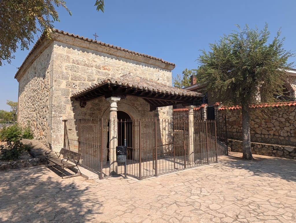
Architecturally, the hermitage is a square chapel, sober and plain, fronted by a portico, an entrance porch, held up by columns in the same plain Tuscan style already seen at the church, and topped with a semicircular arch. The two buildings share more than a passing resemblance. Both went up during the same wave of religious construction that swept the village in the second half of the sixteenth century, a period the village’s own historical materials describe as a genuine flourishing in religious building, with the church and the hermitage standing as its two clearest surviving examples.
The devotional tradition tied to the hermitage has endured for centuries. The Virgen de la Soledad still receives visits and periodic Mass here today, one small, ongoing continuity in a village whose religious life has otherwise passed through real upheaval.
One Village, Two Virgins
We never made it to the Ermita de la Virgen de la Humosa, the village’s other hermitage, home to its actual patron saint, tucked up near the river nearly five kilometers from where we spent that whole eclipse afternoon. Between that distance and the torrid sun beating down that day, walking there wasn’t something we ever seriously considered.
We knew it as we left. A village this layered, fossils and Romans and saints and a war that reached even this small a place, was never going to fit into one day already built entirely around the eclipse. That’s a trade-off we make on purpose: living somewhere fully for a few hours beats racing through a checklist of everything it has to offer, and trying to squeeze in a second hermitage that afternoon would have meant doing neither one justice.
Everything in this essay came from trying to give that overflow somewhere to go. There’s still more of it, waiting a few kilometers upriver for us to come back and finish the job properly.